Map Image (click image for close up)
Vital Statistics
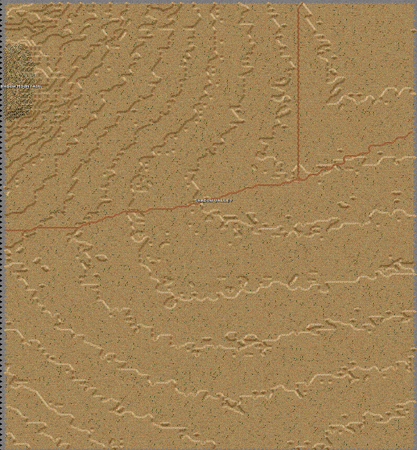
Shadow Valley, California
An area to the east of the National Training Center created using MicroDEM and WW2Map by Fred Chlanda.
I know that this map doesn't look very "bright" or "interesting", but that area really IS that lifeless on Google Earth imagery of that area.
By: Ryan Crierie
Slots used: 304
Download HERE
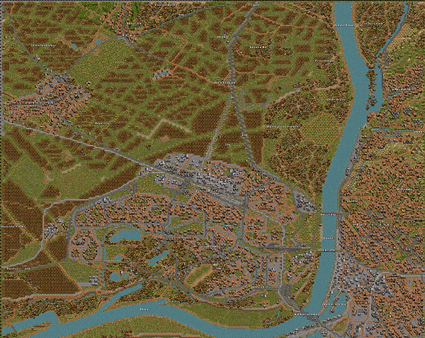
Bratislava - Petrzalka bridgehead
Huge (200x160) map of Bratislava-Petrzalka suburb, effectively a bridgehead and meeting point of Slovakia, Hungary and Austria. State as was between 1970's and 80's. Detailed description added to the archive as .txt file.
Map comes in two variants, with marked Austro-Czechoslovakian border and local names and without both border and names.
By: Marek Tucan
Slots used: 264, 265.
Download HERE
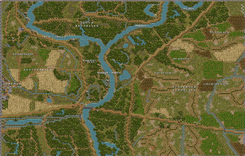
Hohenau (Slovakia/Austria Border)
The map covers a border area where two mid-sized rivers and three countries do meet. The rivers are being surrounded by flood zones, mostly covered with trees. The flood zones are also very wet (surprise) and here-there there is a dead branch of the river or lagoon. They are limited by raised roads that are, in fact, the only elevated points of the map.
On the leftmost map edge, first houses of Hohenau can be seen. Austrian side of the river is littered with recreational cottages, both Czech and Slovakian river banks were parts of restricted border area back in Commie days.
In the rough center of the map, there is a sole bridge across the Morava river. It was built there after 2000, replacing military pontoon bridge built here earlier. The bridge is an official border crossing for any EU inhabitant. The pontoon bridge AFAIK was still there two years ago.
In 1938, a line of light vz.37 bunkers for flanking anti-infantry fires was built along the raised road on Slovakian side. However so far I wasn't able to get some source with their locations.
On the Slovakian part of the map, the surface contains several gullies of various depths, simulated by trenchlines.
The soil in the area is rather sandy, simulated by... well, sand.
Character: Extremely AFV-unfriendly map!
Slots used: 305
By: Marek Tucan
Download HERE
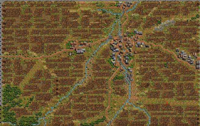

Desna Series Maps (September + October/November)
This map was created specifically for one PBEM (Czechoslovakia meeting Germany, Oct. 1938), but feel free to use it for whatever period and opponents you like.
It covers a village just behind the Czechoslovakian pre-WWII border fortifications line - ie it is a perfect battleground for delay/meeting/counterattack/whatever happens after breakthrough.
Size: 60 x 60
Slots used: 300 and 301
By: Marek Tucan
Download HERE
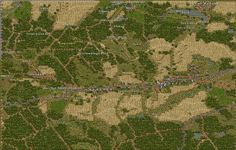
Lodherov (Summer)
Map Orientation:
North=Left side
East=Upper
side
South=Right side
West=Lower side
This is a map of the terrain around a village called Lodherov in the south of Bohemia, about 9 km north of the city Jindrichuv Hradec.
Lodherov is a long village built along a road, founded in the 2nd half of the 13th century by the Order of the German Knights. It is situated in a valley between two ridge lines:
The major one is in the east - the upper part of the map - and is dominated by point 658.8 "Certuv Kamen" (Teufelstein). The southern one is smaller, dominated by point 607.5 "Cihelny Vrch".
There are many ponds located in the area - I have used a mud+streams to simulate them as the water doesn't fit well into higher elevated areas.
Paved roads represent roads with the width of 5+ meters, the rest is shown as dirt roads. Field tracks are presented by "bare earth" hexes.
One height level equals 20 meters, base level 0 lies under 510 meters above sea level.
The map is based on a 1:50,000 scale tourist map, which is based on Czech military maps.
If someone uses this map in a scenario, I'd be glad if he mentions my authorship -- it took me approximately 12-13 hours to make this map.
Download HERE
Size: 100 x 100
Slots used: 302
By: Marek Tucan